© Pyhrn-Priel Panorama | Photo: TVB Pyhrn-Priel / Florian Lierzer
Panorama around the Pyhrn-Priel holiday region.
Accommodation Booking
Arrival
Departure:
search
Search
Close

Kalkalpen Trail stage 8
  • Possible accommodation

 Interactive elevation profile

Download GPS data
Create PDF

Tour-Details

Path number: 218, 290
Starting place: 4575 Roßleithen
Destination: 4574 Vorderstoder

duration: 3h 58m
length: 8,6 km
Altitude difference (uphill): 652m
Altitude difference (downhill): 618m

Lowest point: 1.014m
Highest point: 1.515m
difficulty: medium
condition: medium
panoramic view: Great panorama

Paths covering:
Hiking trail

powered by TOURDATA

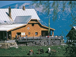
Dümlerhütte Alpine Hut – Zellerhütte Alpine Hut
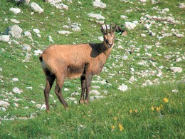
Theme: Alpine Animals – Hunting & Game

Along the 8th stage of the Kalkalpen trail, passing the Windhager lake close to Vorderstoder to the Zellerhütte alpine hut at the northern drop of the Warscheneck mountain, you can listen to over 80 bird species. You might also be able to detect one of the tracks of the over 50 mammal species living in the area.

 Interactive elevation profile

Download GPS data
Create PDF

Tour-Details

Path number: 218, 290
Starting place: 4575 Roßleithen
Destination: 4574 Vorderstoder

duration: 3h 58m
length: 8,6 km
Altitude difference (uphill): 652m
Altitude difference (downhill): 618m

Lowest point: 1.014m
Highest point: 1.515m
difficulty: medium
condition: medium
panoramic view: Great panorama

Paths covering:
Hiking trail

powered by TOURDATA
Protected by