© Pyhrn-Priel Panorama | Photo: TVB Pyhrn-Priel / Florian Lierzer
Panorama around the Pyhrn-Priel holiday region.
search
Search
Close

Kalkalpen Trail stage 9

  • Possible accommodation

 Interactive elevation profile

Download GPS data
Create PDF

Tour-Details

Path number: 201,1,13,11
Starting place: 4574 Vorderstoder
Destination: 4573 Hinterstoder

duration: 4h 30m
length: 12,2 km
Altitude difference (uphill): 781m
Altitude difference (downhill): 920m

Lowest point: 799m
Highest point: 1.505m
difficulty: medium
condition: medium
panoramic view: Great panorama

Paths covering:
Gravel, Hiking trail

powered by TOURDATA

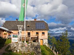
Zellerhütte Alpine Hut – Edtbauernalm Pasture
Theme: Rock & Panorama

From the Zellerhütte, trail no. 201 leads downhill to the Schafferteich pond. At the Schafferteich car park, continue left on paths no. 1 and 13 uphill to the Almresort Baumschlagerberg.

The Kalkalpenweg now follows trail no. 11 to the rustic Steyrsbergerreith mountain hut. Here you will find another place to stop and rest with alpine specialities. Along the forest road, which is also designated as a mountain bike route, the trail climbs gently up to the Redlstein, where the going gets tough once again.

Once you reach the top, you will ...

 Interactive elevation profile

Download GPS data
Create PDF

Tour-Details

Path number: 201,1,13,11
Starting place: 4574 Vorderstoder
Destination: 4573 Hinterstoder

duration: 4h 30m
length: 12,2 km
Altitude difference (uphill): 781m
Altitude difference (downhill): 920m

Lowest point: 799m
Highest point: 1.505m
difficulty: medium
condition: medium
panoramic view: Great panorama

Paths covering:
Gravel, Hiking trail

powered by TOURDATA
Protected by