search
Search
Close

Trails to the Dümlerhütte

  • Possible accommodation

 Interactive elevation profile

Download GPS data
Create PDF

Tour-Details

Path number: 299
Starting place: 4582 Spital am Pyhrn
Destination: 4575 Roßleithen

duration: 2h 52m
length: 3,6 km
Altitude difference (uphill): 712m
Altitude difference (downhill): 59m

Lowest point: 806m
Highest point: 1.459m
difficulty: medium
condition: medium
panoramic view: Individual Views

Paths covering:
Gravel, Hiking trail

powered by TOURDATA

From the parking area pass the tavern Gasthaus Seebauer in Roßleithen.

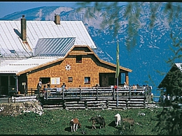
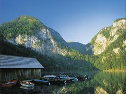
Walk along the western banks of lake Gleinkersee and continue through to the Zick-Alm pasture and from there to your right to the Dümlerhütte alpine hut.

Trail-Nr: 299

 Interactive elevation profile

Download GPS data
Create PDF

Tour-Details

Path number: 299
Starting place: 4582 Spital am Pyhrn
Destination: 4575 Roßleithen

duration: 2h 52m
length: 3,6 km
Altitude difference (uphill): 712m
Altitude difference (downhill): 59m

Lowest point: 806m
Highest point: 1.459m
difficulty: medium
condition: medium
panoramic view: Individual Views

Paths covering:
Gravel, Hiking trail

powered by TOURDATA
Protected by