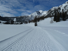
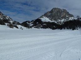
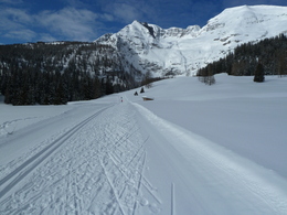

The Wurzeralm high-altitude cross-country trail is a sunny trail with guaranteed snow for all the family to enjoy.
The trail takes skiers across the high and low marshland of Teichlboden, and enjoys a spectacular backdrop at the foot of the Warscheneck mountain.When the Wurzeralm funicular railway is in operation, and when the snow conditions are right!
You can only reach the entry point for the trail by taking the Wurzeralm funicular railway from Spital am Pyhrn. It takes approximately 15 minutes to travel on foot from the mountain station of the funicular railway to the entry point for the trail at Linzerhaus lodge.
There is no charge for using the trail!
However, you require a return ticket for the Wurzeralm funicular railway!
Please get in touch for more information.


")