search
Search
Close

water trail

  • All weather
  • Suitable for families

 Interactive elevation profile

Download GPS data
Create PDF

Tour-Details

Path number: 11
Starting place: 4582 Spital am Pyhrn
Destination: 4582 Spital am Pyhrn

duration: 1h 33m
length: 5,1 km
Altitude difference (uphill): 194m
Altitude difference (downhill): 15m

Lowest point: 640m
Highest point: 826m
difficulty: very easy
condition: very easy
panoramic view: Some Views

Paths covering:
Other

powered by TOURDATA

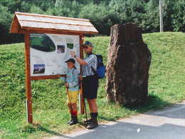
The water course leads you along the Pyhrnbach stream and along the Teilbach stream. Along the way, you will also get to know the Pfleger pond, the valley station of the Wurzeralm funicular railway.

11 information boards give information about the plant and animal world, as well as the geology and bring closer ecological connections. The approx. 5 km long path lies between the town of Spital am Pyhrn and the valley station of the Wurzeralm Funicular. The signs with the information and information boards start about 2 ½ km from the center. The path is well developed ...

 Interactive elevation profile

Download GPS data
Create PDF

Tour-Details

Path number: 11
Starting place: 4582 Spital am Pyhrn
Destination: 4582 Spital am Pyhrn

duration: 1h 33m
length: 5,1 km
Altitude difference (uphill): 194m
Altitude difference (downhill): 15m

Lowest point: 640m
Highest point: 826m
difficulty: very easy
condition: very easy
panoramic view: Some Views

Paths covering:
Other

powered by TOURDATA
Protected by