Accommodation Booking
Arrival
Departure:
<zurückVor>
Mai 2025
MoDiMiDoFrSaSo
   1234
567891011
12131415161718
19202122232425
262728293031 
search
Search
Close

Wildfrauensteig to the Bosruck (B/C)

  • Suitable for families

 Interactive elevation profile

Download GPS data
Create PDF

Tour-Details

Path number: 613
Starting place: 4582 Spital am Pyhrn
Destination: 4582 Spital am Pyhrn

duration: 3h 39m
length: 3,7 km
Altitude difference (uphill): 946m
Altitude difference (downhill): 52m

Lowest point: 1.029m
Highest point: 1.952m
difficulty: medium
condition: difficult
panoramic view: Dreamtour

Paths covering:
Gravel, Hiking trail

powered by TOURDATA

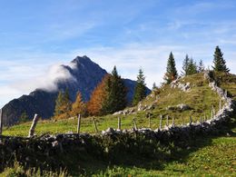
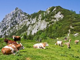
Airy ridge crossing of the Bosruck


Many have driven through the Bosruck, but only very few have climbed to its summit. Far away from the noise of the motorway, this border mountain offers not only a breezy adventure but also breathtaking views of the Gesäuse and Totes Gebirge.

How difficult is it?
You can expect mostly A/B sections, with a few C-points, but also climbing passages on rock with difficulty grade I. Because of the exposed, partly unsecured sections, good surefootedness is a basic requirement! Especially after rain or in fog, the grassy craggy sections are particularly slippery! We do ...

 Interactive elevation profile

Download GPS data
Create PDF

Tour-Details

Path number: 613
Starting place: 4582 Spital am Pyhrn
Destination: 4582 Spital am Pyhrn

duration: 3h 39m
length: 3,7 km
Altitude difference (uphill): 946m
Altitude difference (downhill): 52m

Lowest point: 1.029m
Highest point: 1.952m
difficulty: medium
condition: difficult
panoramic view: Dreamtour

Paths covering:
Gravel, Hiking trail

powered by TOURDATA
Protected by