Fraitgraben


Interactive elevation profile
Create PDF
Tour-Details
Path number: 30
Starting place: 4581 Rosenau am Hengstpaß
Destination: 4580 Edlbach
duration: 1h 48m
length: 6,1 km
Altitude difference (uphill): 157m
Altitude difference (downhill): 138m
Lowest point: 640m
Highest point: 818m
difficulty: easy
condition: easy
panoramic view: No view
Paths covering:
Asphalt, Hiking trail
powered by TOURDATA
From the Hengst Pass road, hike through the Fraitgraben to Ramitscheder Mill, and via the Mitterweng elementary school to Feriengasthaus Grundner in Edlbach.
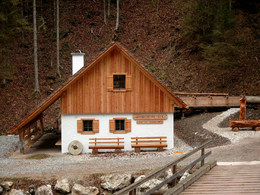
Hengstpassstraße (pass road) - Haselreith (bus stop) – to the waterfall – continue uphills – Stanglmühle (mill) – Flinderlmühle (mill) – Volksschule Mitterweng (primary school)– GH Grundner (inn), Edlbach (bus stop)Trail-Nr: 30
Starting point: Before Rosenau Hengstpass at the Hengstpass-country road at the bus stop Haselreith is the starting point.
Destination: GH Grundner in Edlbach
further information:
- Board possible
")
")
Accessibility / arrival
Windischgarsten take the stallion pass the road towards Rosenau. About 1 kilometer after the turn direction Wurbauerkogel right you will find a parking lot where the trail leads off!
Most economical season
- Spring
- Summer
- Autumn
Please get in touch for more information.

Bahnhofstraße 2
4580 Windischgarsten
Phone +43 7562 5266
Fax machine +43 7562 5266 - 10
E-Mail info@pyhrn-priel.net
Web www.urlaubsregion-pyhrn-priel.at
https://www.urlaubsregion-pyhrn-priel.at
Interactive elevation profile
Create PDF
Tour-Details
Path number: 30
Starting place: 4581 Rosenau am Hengstpaß
Destination: 4580 Edlbach
duration: 1h 48m
length: 6,1 km
Altitude difference (uphill): 157m
Altitude difference (downhill): 138m
Lowest point: 640m
Highest point: 818m
difficulty: easy
condition: easy
panoramic view: No view
Paths covering:
Asphalt, Hiking trail
powered by TOURDATA


